
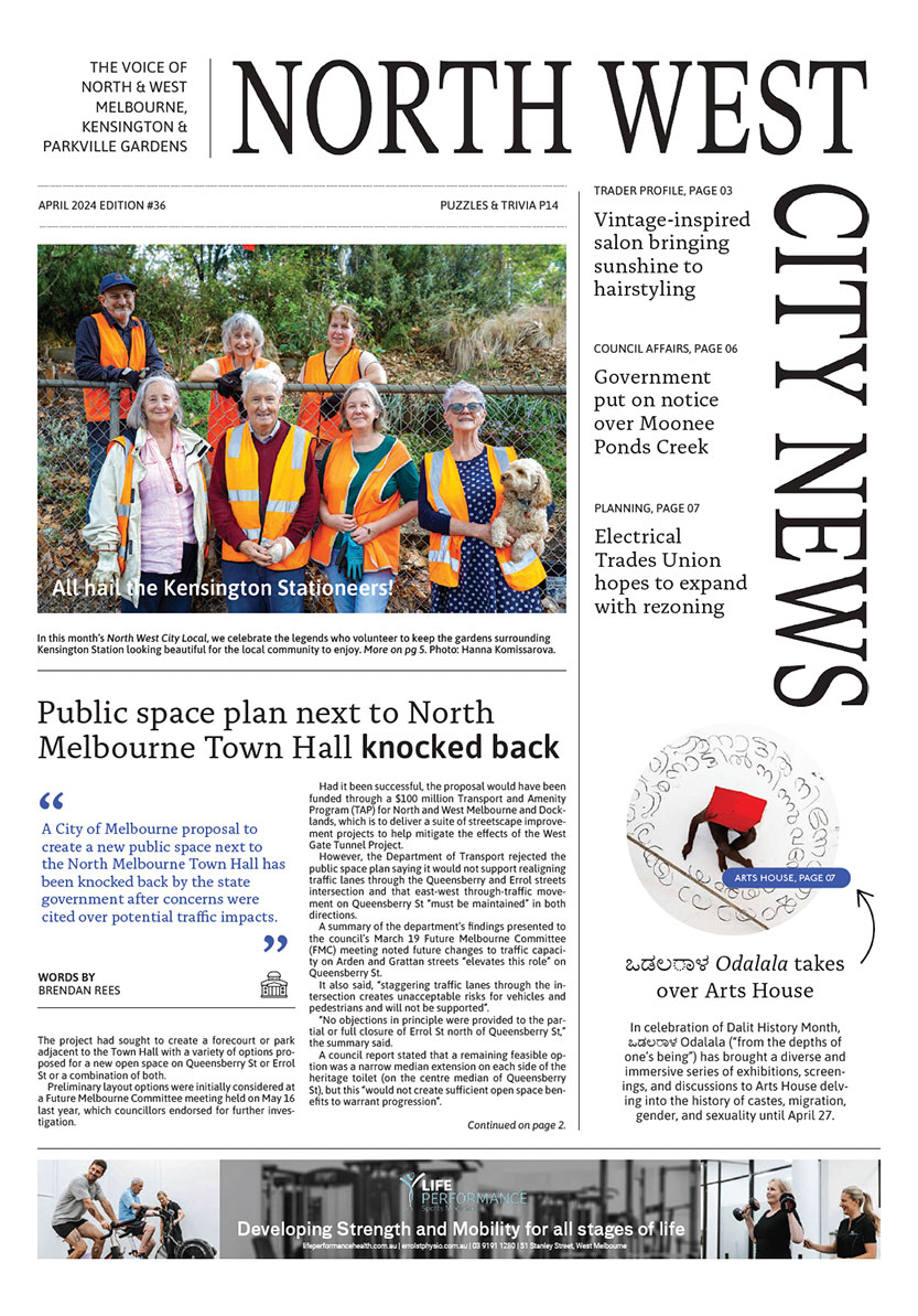
Kensington among top 40 suburbs at “high risk” of floods, study shows

More than 100 properties in Kensington are predicted to be at “high risk of damage” within the next 17 years as rising sea levels and floods were expected to intensify, a new study shows.
The finding was revealed in a recent report commissioned by the Victorian Marine and Coastal Council (VMaCC) and Life Saving Victoria (LSV) with researchers warning that, if no proactive measures were taken, the consequences could be devastating for affected residents and the economy.
According to the report, which included research from the University of Melbourne and consulting firm Climate Risk, it is estimated that by 2100, 151,000 Victorian properties (residential, commercial, and key infrastructure) could be at high risk of damage from rising sea levels and more “frequent and dramatic storm surge and flooding” due to global warming.
The report listed the top 40 suburbs that had the greatest number of properties at high risk of flooding by 2040, in which Kensington was ranked 28th.
It forecast that 2367 properties in Kensington could be exposed to flooding, of which 126 were at high-risk, resulting in a potential damage bill of $2.1 million.
In neighbouring areas, Southbank, which is located next to the Yarra River, was ranked as the number one suburb with 16,646 properties at high flood risk within 17 years, followed by Docklands (3270 properties), which combined, could tally up more than $8 million in damages.
Kensington and North and West Melbourne are divided by Moonee Ponds Creek and the Maribyrnong River, which runs along the western border of Kensington.
According to the Victoria State Emergency Service (VICSES), parklands help to absorb much of the water that helps avoid some flooding in the area, however the flat terrain around the Maribyrnong River makes it easier for flood water to spread in very large rain events.
The Maribyrnong River Flood Review is currently examining the causes and contributors to the flooding event on October 14 last year that devastated Melbourne’s inner west, and flooded parts of Kensington and West Melbourne.
In response to the report, the VMaCC and LSV have called for an independent taskforce to be established to develop and promote “a vision and operational blueprint” to guide Victoria’s response to rising sea levels and related storm surge.
“We know that climate change is going to hurt many Victorian communities if we do not act,” VMaCC chair Dr Anthony Boxshall said.
“This rigorous report clearly and comprehensively documents the economic challenges that Victoria’s coastal communities will face from sea level rise and related storm surges.”
Dr Boxshall said spending on adaptation over the next two decades could help reduce future risk and “save significantly on the estimates of future costs”.
Speaking of ways to ensure future development was designed with flood resilience in mind, City of Melbourne Deputy Lord Mayor Nick Reece said the council was responding to the challenges of flooding and climate change.
“Our planning and building rules are designed to preserve the quality architecture and design of Melbourne streets and built form but also recognise the challenges of increased future flood events,” he said.
This is not about building fortresses and walls – it’s about well-designed beautiful buildings and streets that are climate-resilient.
According to the Macaulay Structure Plan, a framework endorsed by the council last year to guide the vision of North Melbourne and Kensington, recognised that “climate change impacts will result in more intense rainfall events, increasing the magnitude of flooding, waterway levels and storm surges.”
“Future resilience planning for Macaulay will be undertaken collaboratively with the community and key partners from the precinct, seeking to identify opportunities for ongoing resilience,” the framework read.
Significant floods have occurred in North Melbourne and Kensington in past years, including a significant event of flash flooding in January 2011, which saw cars trapped in flood waters in Stubbs St and Macaulay Rd. However, drains and infrastructure improvements have reduced the risks of similar flooding occurrences.
Kensington Association chair Simon Harvey said the report “makes it crystal clear, we do need an operational blueprint to guide the responses to the threat of coastal inundation, but we also urgently need one for each of the other primary threats - fires, floods, and drought”.
“Although we don’t live directly on the coastline, the effect of coastal inundation will filter down to the whole community. It’s important to note that the assumptions used in the modelling for the report are thought to be conservative.” •

Jo Ryan unveils Ordered Chaos at Blender Studios

Kensington Rec Centre construction progressing
 Download the Latest Edition