Residents invited to have their say on proposed flood overlays

The community is being invited to view and comment on a proposed planning amendment, which revises the City of Melbourne’s proposed flooding overlays.
The council has been given approval by Minister for Planning Richard Wynne for Amendment C384 to be prepared, which aims to identify areas prone to flooding, sea level rises, increased rainfall intensity “that are predicted to influence inundation in the near future”.
The City of Melbourne has partnered with Melbourne Water to update its flood modelling for a number of areas in the municipality.
The proposed changes to Land Subject to lnundation Overlay and Special Building Overlay apply to land affected by riverine flooding and drainage flooding respectively, including corresponding changes to the relevant schedules and mapping in the Melbourne Planning Scheme.
The amendment also includes a background document, the Design Guide for Flood Affected Areas in Fishermans Bend, Arden and Macaulay which seeks to provide guidance for how to design flood resilient buildings in these areas.
According to a letter sent to residents by the council regarding the proposed amendment, the “patterns and intensity” of rainfall and possible flooding has changed “over the years”, with climate change and more intense development being contributing factors.
“This needs to be accurately shown in the Planning Scheme,” the letter read. “Amendment C384 has been prepared to require that any new development is designed to ensure safety and minimise flood impact.”
All affected property owners have begun receiving letters advising them of the changes and are encouraged to view the amendment and documents online.
Associate Professor Andrew Butt from RMIT’s Centre for Urban Research said the council’s review of flood overlays was “very timely” given the proposed development at the Arden and Macaulay precincts, which would need to be “very clear of the flood controls and the flood impacts”.
“A good response would be something like in Arden and Macaulay, we should be looking for permeable surfaces wherever possible,” he said, which would allow water to filter through the ground below.
“Once you start building up things and putting in hard surfaces, you also alter the flood habits.”
“Arden and Macaulay are flood prone, but the main issue is what do we do about it if we start development? It shouldn’t preclude development, but it should mean it’s sensitive to that risk.”
Associate Professor Butt added what planning controls were applied and what it might mean for development “aren’t clear but they’ve got a lot of options and they aren’t all about stopping development occurring”.
“Modelling is dynamic in a number of ways, we’ve got unknowns around things like climate change … but equally in urban areas of course, small interventions that get made have implications elsewhere too.”
The closing date for submissions is November 29 •
Related Articles

High Court to hear public housing tower demolition challenge
The long-running legal battle over Victoria’s public housing tower demolition program is heading to the nation’s highest court, in a major development for residents in North Melbourne and Kensington fighting to stop the destruction of their homes.
Read More
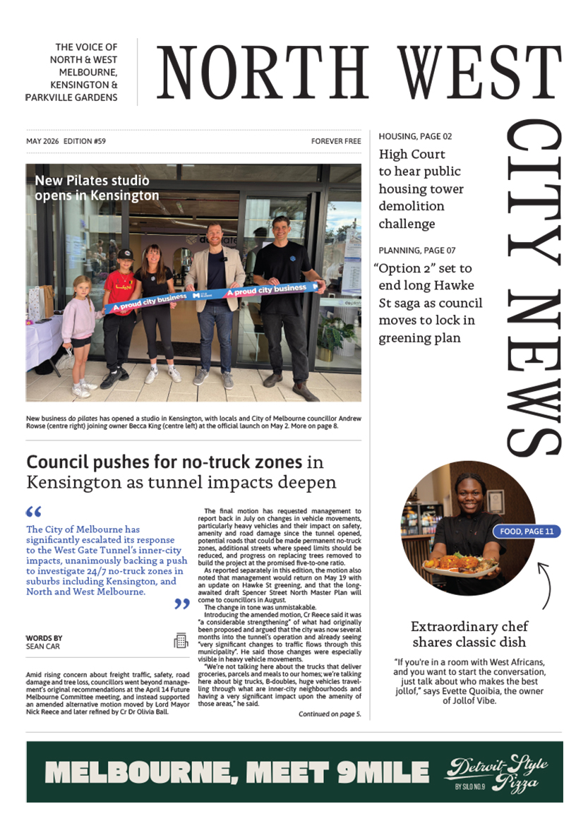
Council pushes for no-truck zones in Kensington as tunnel impacts deepen
The City of Melbourne has significantly escalated its response to the West Gate Tunnel’s inner-city impacts, unanimously backing a push to investigate 24/7 no-truck zones in suburbs including Kensington, and North and West Melbourne.
Read More
Fresh budget funding keeps Arden Secondary School moving, but questions remain
The long-awaited Arden Secondary School has received a further funding boost in the Victorian Budget, offering another positive sign that planning for the new inner-city high school is continuing, even if key details remain frustratingly unclear.
Read More
All Things Equal: a café where inclusion comes first

Council pushes for no-truck zones in Kensington as tunnel impacts deepen
 Download the Latest Edition