Trekking through North and West Melbourne to Geelong, and fording the Moonee Ponds Creek
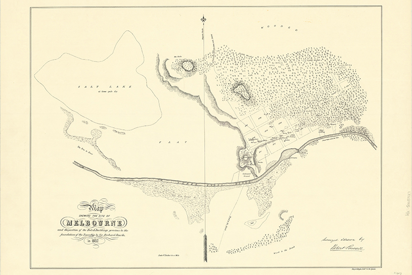
One of the earliest maps of Melbourne, the Robert Russell 1837 map, when Melbourne’s population was only a few hundred shows a “Track to the Saltwater River and Geelong”.
This map shows the track start at the corner of Flinders and Swanston streets, going diagonally westerly across to between King and Spencer Streets, then going north-westerly past Burial (Flagstaff) Hill, and the most northern section finishing around Hotham Hill, North Melbourne. That’s as far as the map goes.
An 1836 map a year earlier by John Helder Wedge, a surveyor who was part of Batman’s settlement group, also shows a track to Geelong.
A later 1856 map (below) shows a track, likely the same track as in Russell and Wedge’s maps, or a fork of it, going through “Section 16” just above Macaulay Rd, near Stubbs St and where Mark St and Robertson St are - which were one street in the original subdivision.
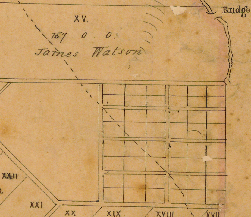
The Moonee Ponds Creek is shown as finishing at the top of Section 16, and not as running through it, although it did in some form.
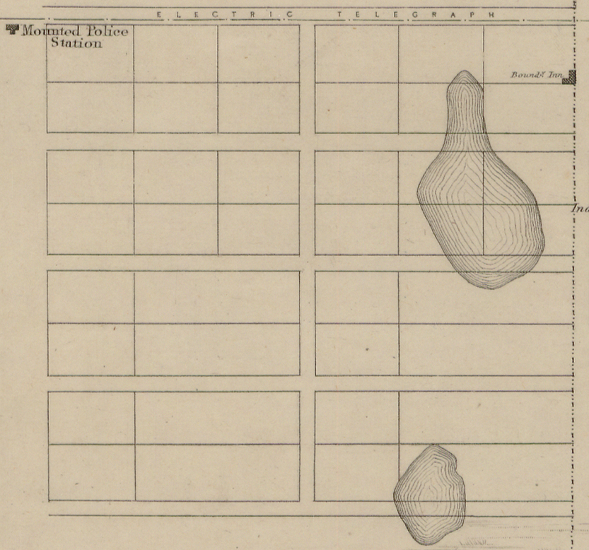
While the track is not shown in the 1855 Kearney map (below), two ponds are, and other maps as descriptions describe the area as a marsh or swamp. The crossing would have been at the end of what is now Mark St, just above the lower pond.
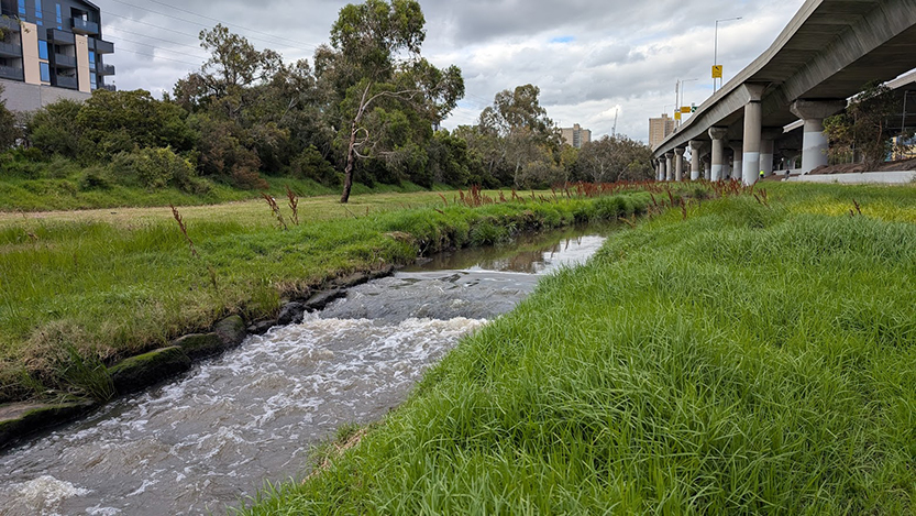
Curiously there is now a rock ledge at about the same place as where the track on the 1852 map would have crossed the Moonee Ponds Creek, just up from Macaulay Rd, presumably some sort of ford. Here are two recent photos of the location.
When Citylink was built in the late 1990s the Moonee Ponds Creek between Macaulay Rd and Racecourse Rd was “naturalised”. The old 1880s, or thereabouts, bluestone dead straight channelling was removed, and the creek was given a sinuous shape. Rocks were placed along the bank and some trees planted in the creek bed.
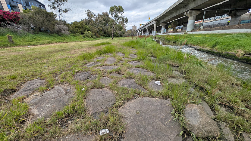
Are the rocks in the photo above part of that naturalisation effort, or are they part of the “old volcanic basalt” lava? Either way perhaps the location is worthy of being recognised, as (near) where the “Track to the Saltwater River and Geelong” went across the Moonee Ponds Creek. Particularly as it is thought that some of the old tracks were based on First Peoples' walking tracks.
The tracks were gradually replaced by roads and rails, with few traces left, maybe this is one such trace, or could be imagined and remembered as such. •
Related Articles
1851: North and West Melbourne
July 1, 1851, was an important date in the history of Victoria, and particularly for North and West Melbourne.
Read More
John Jones 1836-1909: West Melbourne builder
David Evans is a long-time member of the Hotham History Project.
Read More
Changing names: Flemington, Flemington Bank, Flemington Bridge
When first subdivided and sold in 1849 the area bounded by Boundary Rd, Racecourse Rd, Rankins Rd Kensington and Macaulay Rd, with the Moonee Ponds Creek in the middle, was known as Flemington. Stubbs St is the north-south road in the middle.
Read More
All Things Equal: a café where inclusion comes first
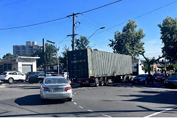
Council pushes for no-truck zones in Kensington as tunnel impacts deepen
 Download the Latest Edition