Master plan charts bold 20-year vision to grow and reunite Royal Park

The City of Melbourne has unveiled a sweeping new 20-year vision for Royal Park that seeks to make Melbourne’s largest inner-city park bigger, darker, greener and – ultimately – whole again.
The final Murrup Biik – Royal Park Master Plan 2026, which went before councillors on August 18, represents the most significant rethink of the 161-hectare park in decades and builds on the influential 1984 and 1997 master plans that shaped much of the landscape seen today.
Its ambition is summed up in a simple idea: Royal Park has been progressively “nibbled away” by roads, railways, car parks and development, and the park of the future should be “re-established, united and whole once again”.
More than 1800 people participated in consultation during 2024 and 2025, with biodiversity, lighting, recreation and fragmentation among the strongest themes. Following criticism of the draft, the council commissioned an independent peer review, resulting in a substantially revised document that has been broadly welcomed by park advocates.
Friends of Royal Park member Kaye Oddie described the final version as a “much, much better document”, particularly welcoming its stronger emphasis on biodiversity, ecology and Wurundjeri collaboration.
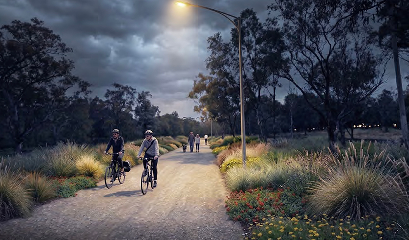
One of the clearest changes is lighting.
The draft attracted strong opposition from residents and environmental groups concerned that additional lighting would erode Royal Park’s traditional role as a “dark park” and harm nocturnal wildlife.
The final plan explicitly calls for darkness to be maintained and unnecessary lighting minimised, while pursuing international recognition as an “Urban Night Sky Place”.
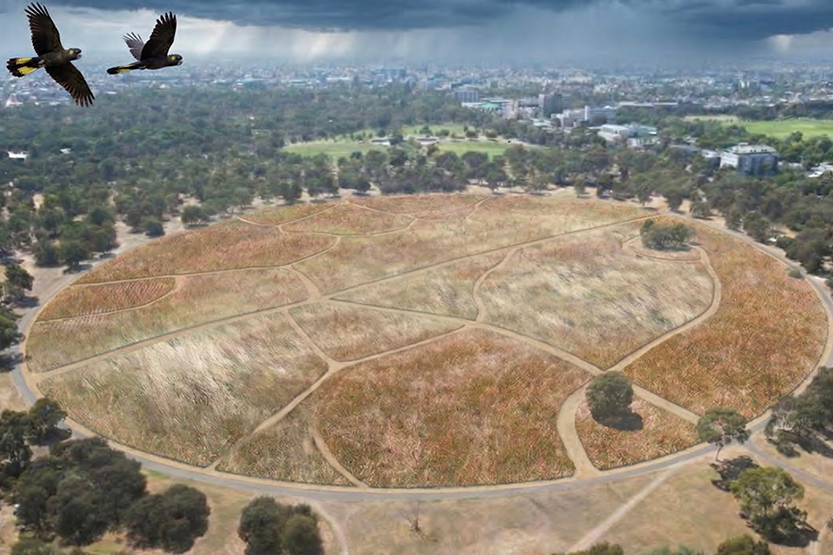
Dark refuges such as the Grassland Circle and golf course would remain unlit throughout the night, while lighting elsewhere would be concentrated around sports grounds, key destinations and major movement corridors. The plan adopts the principle of lighting only where needed, when needed and no brighter than necessary, with a general dark period between 10.30pm and 5am.
There has also been a retreat from some of the draft’s more intensive recreation proposals.
Ideas for new tennis courts, miniature golf and several large multi-use recreation spaces have been removed, while Lawn 7 will remain principally an informal recreation area rather than being converted into formal sporting fields. The final direction is for the area to remain largely open and grassy, without the lighting and built infrastructure contemplated in the draft.
A new assessment framework will instead guide future recreation proposals, providing greater scrutiny of whether activities are appropriate for Royal Park and whether they conflict with its environmental values.
The treatment of paths has also changed substantially. Rather than formalising numerous routes through sensitive areas, including the Grassland Circle, the final plan recognises informal tracks and removes much of the earlier language around widening and paving.
Another controversial draft concept – a loosely defined “biolink” through the park – has disappeared altogether. In its place is a broader approach that treats Royal Park as an ecologically significant landscape as a whole, with greater emphasis on strengthening habitat and biodiversity connectivity across the entire park.
Concerns over commercialisation around heritage buildings such as Walmsley House have similarly softened, with the final plan focusing more heavily on public, community, cultural and nature-based uses.
But the plan’s most transformative ideas are contained under its principles to “Grow the Park” and “Unite the Fragments”.
Royal Park once covered around 400 hectares. By 2013, successive excisions for roads, rail, the zoo, hospital and sporting facilities had reduced it to around 164 hectares.
Rather than simply defending what remains, the new plan adopts a “net gain” ambition – progressively reclaiming land from roads and car parks. It also strengthens the council’s longstanding “no net loss” policy by requiring an accurate baseline of parkland area so future losses and gains can be properly measured.
Surface parking currently occupies about five per cent of the park. The long-term objective is to remove much of it from the park’s interior, rationalise existing spaces and investigate underground parking beneath Melbourne Zoo and the State Netball and Hockey Centre.
Informal parking north of the zoo, around sporting fields and beside pavilions could progressively return to parkland.
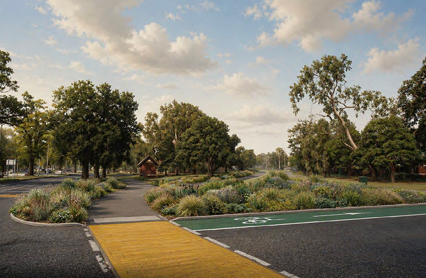
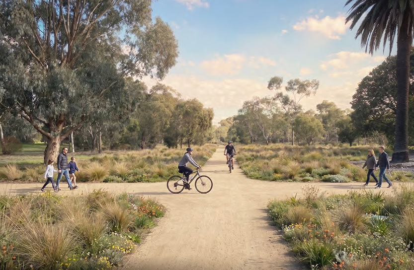
An AI-assisted image of the proposal to close The Avenue looking from Park St.
Some changes appear relatively achievable. Old Poplar Rd and the Women’s Pavilion car park could disappear as part of future rail works, while sections of The Avenue could be closed, returning road space to parkland. The same goes for Brens Pavilion Drive, Poplar Rd and the Ross Straw Field Pavilion Driveway.
Others are far more ambitious.
The plan proposes eventually removing Brens Drive – the principal entrance to the State Netball and Hockey Centre and Urban Camp – and replacing it with a shorter access route aligned more closely with the tram corridor.
North West City News contacted the State Netball and Hockey Centre about this proposal, but it declined to comment.
Along Park St (pictured below), the council wants to investigate narrowing the oversized road reserve to reclaim around 4160 square metres of additional parkland.
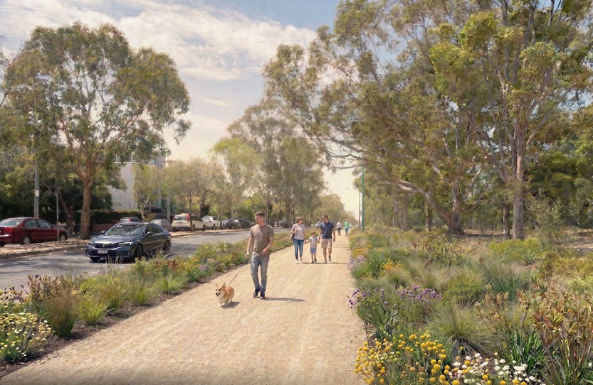
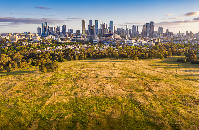
Most consequential is Elliott Avenue and Macarthur Rd (pictured main).
The master plan describes the 1950s decision to carve the arterial route through Royal Park as “fateful”, severing the park’s north and south.
In the shorter term, the council wants to explore reducing the road footprint. Its longer-term ambition, however, is to remove Elliott Avenue and Macarthur Rd altogether and restore a continuous landscape through the heart of Royal Park.
The proposal would be politically difficult given the volume of traffic carried by the route, but it captures the central philosophy of the plan: reversing decades of fragmentation rather than accepting it as permanent.
That long-term protection is also politically significant. The document explicitly identifies a revived East West Link as a threat that could again place construction sites, ventilation structures and road infrastructure within Royal Park, reinforcing the importance of having a strong long-term planning framework in place.
The railway is another major barrier.
Alongside new pedestrian crossings and bridges, the plan proposes investigating whether a section of the Upfield rail embankment could eventually be replaced with an elevated viaduct (pictured below).
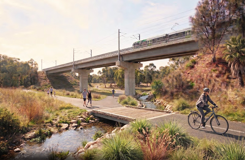
That could restore the original landform beneath the railway, reconnect waterways and allow people and wildlife to move more freely between parts of the park. An alternative would involve pedestrian tunnels through the embankment.
The impending Park St level crossing removal provides another opportunity, with the council hopeful that surplus rail land could ultimately be reclaimed as parkland.
The Royal Park Golf Course could also be significantly reshaped, with all nine holes consolidated west of the railway. While not a new idea – versions of it have appeared in earlier master planning – the final plan puts it firmly back on the agenda.
The Council estimates this could return around 40,000 square metres south of the tracks to general parkland while removing around 50,000 golfer movements across the Poplar Rd level crossing each year.
Water is another defining theme.
The plan proposes daylighting buried drains and former waterways, improving the Billabong, restoring Royal Park's creek and creating new wetlands and water sources for wildlife.
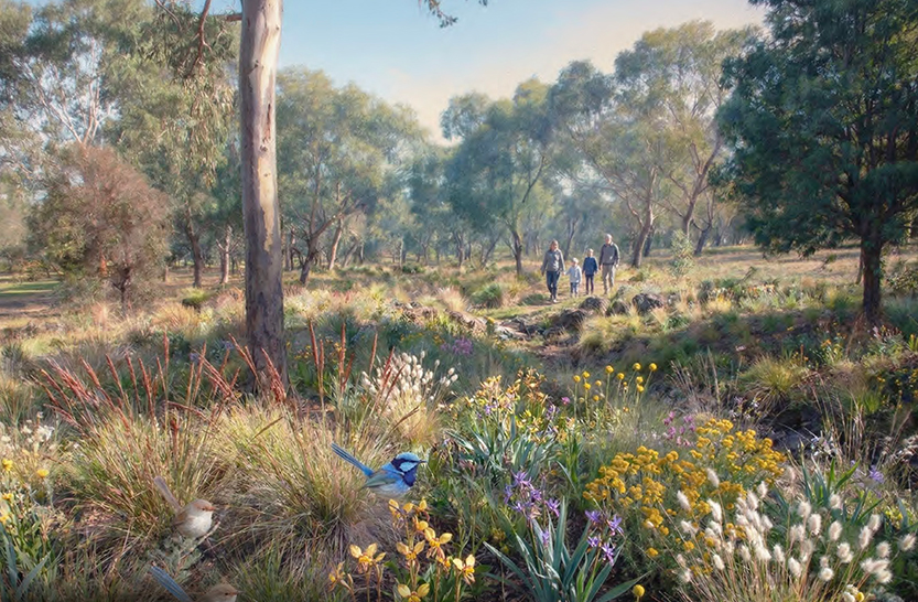
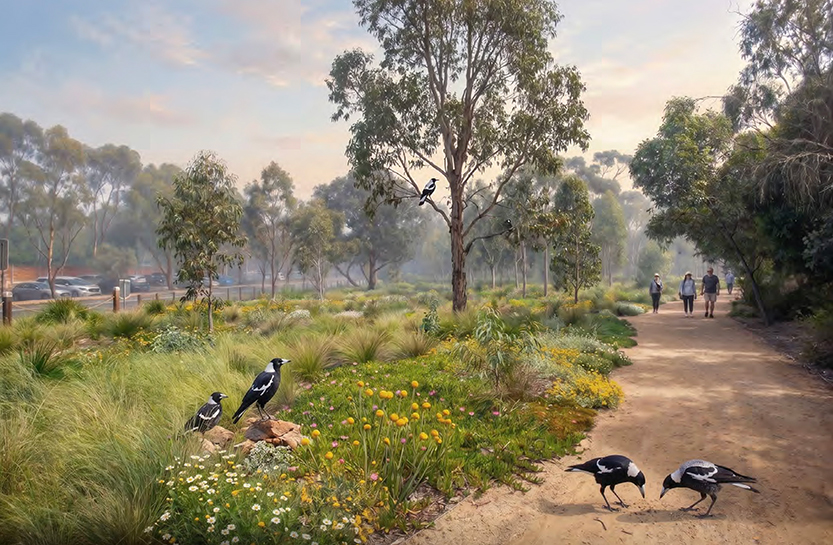
A proposed swale (pictured above) associated with the future removal of Brens Drive remains contentious. Friends of Royal Park instead wants the council to investigate reinstating the historic creek line west of Brens Drive rather than creating a new alignment.
The group also wants the council to go further in expanding the narrow Royal Park creek corridor near the former CSL land, advocating for government-owned land along the western boundary to contribute to a wider biodiversity corridor.
The plan also outlines a long-term objective to reconnect the park with Moonee Ponds Creek, including investigation of a wildlife and water connection beneath major transport infrastructure – an idea that adds another layer to the broader ambition of repairing connections severed over generations.
Despite its support for the overall direction, Friends of Royal Park says one issue still requires further consultation: vegetation.
Ms Oddie said the group wanted greater clarity about proposed changes to planting associations and how increased understorey planting might alter Royal Park’s characteristic open grassy woodland.
“We just want to be able to discuss why they want to change things,” she said, calling for further engagement with environmental groups and people with long-standing knowledge of the park.
At the centre of the plan is also a strengthened partnership with the Wurundjeri Woi-wurrung people.
The name Murrup Biik, meaning “spiritual land”, was provided by Wurundjeri Elders, while Caring for Country principles are embedded throughout the plan – from cultural land management and ecological burning to waterways, night skies, education and future decision-making.
The master plan contains 252 actions and many of its grandest ideas could take decades – or never be realised at all. Major road, rail and parking changes would depend heavily on state government cooperation and future funding.
But that is partly the point.
Like the master plans that preceded it, Murrup Biik is designed less as a construction schedule than a generational statement about what Royal Park should become.
Its strength may ultimately be measured by how well it survives political cycles. The previous Royal Park master plan endured for decades and, according to former councillor Rohan Leppert, the final Murrup Biik document is considerably more cohesive and potentially durable enough to do the same.
If even a substantial portion of the vision is realised, future Melburnians could inherit a park with fewer roads and cars, restored waterways, stronger wildlife corridors, larger areas of native landscape and far better connections between areas that today feel like separate parks.
For a place that has spent more than 150 years being gradually carved apart, the defining ambition of the next era is remarkably simple: begin putting it back together. •
Related Articles
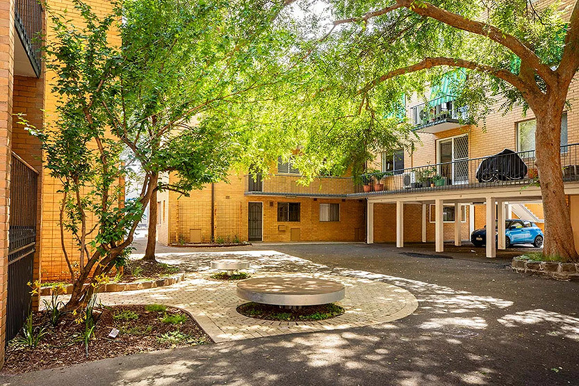
North Melbourne courtyards and car park given green boost under council grants
Three residential greening projects in North Melbourne will share more than $200,000 through the City of Melbourne’s latest Urban Forest Fund grants program.
Read More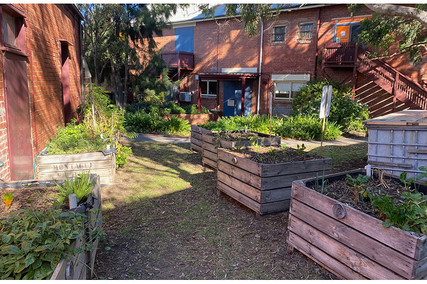
Garden rules to green inner north-west streets
Residents and businesses in North Melbourne, West Melbourne and Kensington will be able to more easily green their streets under new City of Melbourne guidelines designed to support community-led gardening outside the CBD.
Read More
Urban forest plans aim to cool growing inner north-west
North and West Melbourne and Kensington will be targeted for new tree planting, biodiversity corridors and more resilient streetscapes under updated urban forest plans to be considered by the City of Melbourne.
Read More
Meet Ted – Brown Dog’s very own Brown Dog
New-look Joe Taylor brings Thai flavours to Errol St
 Download the Latest Edition